Search Results
280 results found for ""
- Onward to Seward, Alaska
The trip to Seward took us back the way we came through Ninilchik, Soldotna and Cooper Landing on the Sterling Highway. The intersection with the Seward Highway happens at beautiful little Tern Lake where we turn southeast and drive through the town of Moose Pass. Five miles south is Trail River Campground which is set between the Trail River and Kenai Lake, providing lake, river and snow-capped mountain scenery among the hemlock and spruce forests of the Chugach National Forest. It lies within driving distance of two main tourism destinations; 24 miles north of Seward and 40 miles east of Cooper Landing, AK. This would be our base camp for the next four days, Tuesday July 16 through Friday, July 20. The campground was divided into three loops. Our camp sites were located in Spruce Tree, the first come, first serve loop which had ample campsites available with some shade along with stellar views of the mountains. The Eagle Point Loop overlooking the beautiful Kenai Lake and the River Terrace Loop nearest to the river were by reservation only. Miles of hiking and biking trails weave throughout the area. Moose, brown and black bear, sheep and goats can be found across large parts of the forest. Kenai Lake marks the headwaters of the Kenai River. This campground is situated on the Eastern Kenai Peninsula at an elevation of 450 feet. Our decision to stay at this particular location was based on observations we made in Homer. Most of the city campgrounds were relatively pricey and crowded with sites much too close together. Granted, they did include full hook-ups, but we really prefer dry camping and using our own water, battery power plus holding tanks for the days we planned to be in the area. My solar wasn't going to be enough if the weather was overcast and rainy. However, all of our rigs had generators to charge the trailer's batteries when necessary, so power generation wasn't of any concern. Our campsite price was a bargain at only $11.50 per night in this National Park, with a quiet setting and breathtaking scenery around our spacious sites. We knew this would be a fine location for the duration, even with a 25 mile drive into Seward. Seward, Alaska is a port city in southern Alaska set on an inlet in the Kenai Peninsula. It’s a gateway to Kenai Fjords National Park, where glaciers flow from the Harding Icefield into coastal fjords. Surrounded by peaks, the fjords are a whale and porpoise habitat. The city’s Alaska SeaLife Center houses seals and puffins; fishing boats fill Seward Harbor. The city was named for President Lincoln’s Secretary of State, William Henry Seward (1801-1872), who engineered the purchase of Alaska from Russia. As history books tell the story, in 1867 Secretary of State William Seward secretly negotiated with Russian officials to purchase the Alaskan territory for $7.2 million, putting Alaska on the road towards statehood in 1959. This was a bargain price at two cents per acre. Though the treaty was mocked by some at the time, “Seward’s Folly” is regarded by history as a masterful deal. Because the land was located so far north, it was considered virtually unusable and uninhabitable. Because of these factors, Alaska was not seen as a worthwhile purchase for the United States and was thus considered a foolish endeavor, hence the Seward's Folly definition. Below his statue in town is a quote, “The purchase of Alaska was my greatest achievement, but it will take the people of the United States a generation before they realize it.” With the later discovery of both gold and oil in Alaska, he was certainly correct! Our first activity planned in Seward on Wednesday, July 17 was Seavey's IdidaRide Sled Dog Tours. We visited the Seavey Family Homestead in Seward, and toured their beautiful tether free summer camp for Iditarod athletes! Meeting the dogs, feeling their excitement as teams were hitched to their comfortable summer sleds and then mush for two miles through the scenic rain forest was a joy. Upon return to the kennel we got to meet with the dogs, cuddle adorable puppies, try on the parkas worn on the Iditarod, check out the race gear, and learn about these incredible dogs and mushers. It may seem odd to mush on wheels, but Alaska only has snow for 4-5 months in the winter. The same dogs that run and win the Iditarod do these tours; it's how they stay in shape during the off-season! Thursday, July 18 was spent on the water, in my happy place of course. We purchased seats on the Major Marine 7.5 hour cruise exploring the Kenai Fjords National Park, where wildlife is abundant and tidewater glaciers are massive. Providing a full narration on our journey, our knowledgeable onboard captains and naturalists took us to spectacular sights while answering any of our questions. With 7.5 hours on the water, this cruise allows more time for the captain to seek out the best whale and wildlife viewing opportunities in the area. We got to spend time in front of two active tidewater glaciers: Holgate and Aialik Glaciers. Upon our return we witnessed a large pod of Humpback whales "bubble net hunting". Bubble-net feeding is a cooperative feeding method used by groups of humpback whales. This behavior is not instinctual, it is learned; not every population of humpbacks knows how to bubble net feed. Humpback whales use vocalizations to coordinate and efficiently execute the bubble net so they all can feed. As the group circles a school of small fish such as salmon, krill, or herring, they use a team effort to disorient and corral the fish into a "net" of bubbles. One whale will typically begin to exhale out of their blowhole near the school of fish to begin the process. More whales will then blow bubbles while continuing to circle their prey. The size of the net created can range from 10 feet to 100 feet in diameter. One whale will sound a feeding call, at which point all whales simultaneously swim upwards with mouths open to feed on the trapped fish. As the whales swim up to the surface to feed they can hold up to 15,000 gallons of sea water in their mouths. Humpback whales have 14 to 35 throat grooves that run from the top of the chin all the way down to the navel. These grooves allow the mouth to expand. When they swallow, they stream the water out through their baleen as they ingest the fish. The fish that they ingest are also a source of hydration for them. Bubble netting is an advanced and necessary feeding method developed by humpback whales to feed multiple mouths at one time. On our last full day in Seward we hiked out the the Exit Glacier. There are some glaciers you can drive to, but very few that you can stroll to. With just a 10-to-15-minute drive out of Seward, you can hike right up to the Kenai Fjords National Park's Exit Glacier and experience the dense, blue ice while listening to it crackle. One of the most visited glaciers in the world, Exit Glacier earned its name from grateful back-country travelers. It descends about 3,000 feet in just a few miles, forming a stunning, natural ramp for mountaineers exiting the immense Harding Icefield. Its hard ice—fluted and crevassed—is close to a visitor center in the only portion of Kenai Fjords National Park that’s accessible by road. This setting has a primeval feel with scoured bedrock, craggy ice, rushing water, and a flourishing new forest with towering cottonwoods above jungled thickets.
- Continuing South to the Kenai Peninsula
After our three days in Susitna Landing, the plan was to head south to just north of Anchorage, Alaska. Our route took us through Wasilla, Alaska (hometown of former Alaska Governor and Senator John McCain's Vice Presidential running mate Sarah Palin). We stopped for groceries at the local Walmart before continuing on to Eagle River Campground, a Chugach State Park. for one night on Thursday. This campground is outside Anchorage about 12 miles up the Glenn Highway in Eagle River, Alaska. We were able to re-fuel there before continuing south the next day to Anchorage to get fresh water and dump our black and gray water storage tanks. The destination for Friday, July 12 was the small waterfront hamlet of Hope, Alaska. To get there we would continue traveling south out of Anchorage 102 miles on the Seward Highway along the Turnagain Arm of the Cook Inlet. It took about two hours to reach the Porcupine Campground at mile 18 up the Hope Highway. According to the information we had, "Visitors and Alaskans alike flock to the Kenai Peninsula to enjoy the great outdoors, but most drive right past the Hope Highway turnoff at Mile 56.3 of the Seward Highway without knowing what they're missing. This 17-mile detour lets you explore the history of one of Alaska’s first gold-rush towns." Currently home to fewer than 200 residents, the village once housed 3,000—all drawn by gold fever. In 1889, a few years before the Klondike gold rush began to lure people north, a miner discovered nuggets in nearby Resurrection Creek. Soon prospectors found gold in many area streams—including Bear, Sixmile, Canyon and Mills—triggering the 1890s Turnagain Arm gold rush. According to local lore, this growing community of tents and cabins chose to name their town after the youngest rusher to step off the next boat—17-year-old Percy Hope. Whether or not the story is true, the name certainly evokes the optimism of every prospector who arrived in Hope in search of a fortune. Hope, however turned out to be a bit of a let down. Most of the buildings and museums were closed. The local saloon was advertising an Irish band that night, but the cover charge was $30 each so we bought a few drinks and returned to our campground. The site was tight but the price was right at a mere $11.50 a night with the National Park Pass 50% discount. Saturday morning found us on the road again (another three hours and 153 more miles) enroute to Anchor Point just a few miles north of Homer, Alaska. This would be the home base for the next three days instead of trying to find a campground site on the Homer Spit. Weekends are notoriously busy in most campgrounds everywhere, so we opted for the Slide Hole Campground off the Sterling Highway. This campground is one of several in the Anchor River State Recreation Area. The campground closest to the water is Halibut Campground, our original planned location, but it was full on Saturday late morning when we arrived, so we chose this nearby campground which was a nice second alternative. It is still close enough to the beach that a walk is easy. It is a fairly busy campground with lots of coming-and-going and non-campers driving through, but it calms down at night and is fairly quiet. It is a wooded area with good separation between sites. There is a fresh water fill, but no dump station. The toilets are vault toilets. There are long generator hours from 6 in the morning until 11 at night. Our Verizon internet server worked well here. The main activity here is fishing. It was a pleasant campground in wooded surroundings. We would stay here again because the drive into Homer was easy and the sites were less crowded than in town or on the spit. After setting up our individual campsites we all ventured into the town of Homer and the Homer Spit to get our bearings. Properly dressed with raingear we walked around and eventually ended up at the Harbor Grill restaurant for a late lunch, early dinner. I had to have the Halibut & Chips and Karen had the Halibut Tacos. Homer is known as the Halibut Capital of the World, so it was only appropriate we try them out! Both entries were good but not "over the top" out of this world outstanding. Sunday, July 14 Karen and I, along with Jeff and Dana Guidi, took a ferry boat at 11:00 AM just 15 miles across Kachemak Bay from Homer to Seldovia, a small coastal community with authentic Alaska appeal. Locals call their town the “City of Secluded Charm,” and it’s hard to argue with them. Set among a maze of peninsulas, straits, and lakes, the isolated community of 300 residents has managed to retain much of its character. It was easy to walk the entire town and was an enjoyable escape for the day. The Seldovia area is the traditional homeland of the Sugpiaq people who have lived in the area for thousands of years. When Russian traders arrived in the area seeking sea otter pelts and timber to repair ships, Seldovia became an important shipping and supply center for the region. Salmon and herring runs supported several canneries by the 1920s. After the Sterling Highway was completed to Homer in the 1950s, Seldovia’s population and importance as a supply center began to dwindle, but it was the 1964 Good Friday earthquake that caused the most rapid change in the community. The earthquake caused the land beneath Seldovia to settle four feet, forcing residents to rebuild much of their community on higher ground. During our four hour visit we walked the town built on wooden pilings supporting many of the unique waterfront homes. We observed a large community of Bald Eagles flying above the entire area. In the harbor, a solitary Sea Otter floated on his back, napping as boat traffic came and went, in and out of the small local harbor. We even found some interesting wooden sculptures for Karen to enjoy! Before heading back to the harbor we grabbed a snack at a local eatery before boarding the ferry boat at 4 PM for the return trip back to the Homer Spit. Our last day in Homer was a mixed bag of meeting our friends, Jay and Laurie Johnson for coffee and a snack, doing our laundry, getting our Honda portable generator repaired and visiting the Alaska Islands and Ocean Visitor Center.
- Adventures out of Talkeetna, AK
We wanted to do something to make up for not being able to experience the Denali National Park. Our decision was to extend the exploration of the small town of Talkeetna over the course of two days while we camped at the Susitna Landing Campground. On Tuesday, July 9th we drove into Talkeetna and walked around to get an overall feel, eat some lunch and schedule a jet boat tour for the afternoon which travels up one of the three rivers that converge here. Our 2-hour boat trip began aboard the fifty-two passenger “Talkeetna Queen". We traveled twenty miles up the Susitna River; our captain and the naturalist talked about the history and rivers in the area, as well as information about the greater Denali area. We stopped to take a ¼-mile leisurely nature walk to a Dena’ina Indian Encampment; they were the earliest native settlers in the area. We also visited an authentic trapper’s cabin with its original furnishings and viewed how trappers lived in “Bush” Alaska at the turn of the century. We saw a demonstration about trapping methods and viewed a display of animal furs from the local area. Before leaving Talkeetna, we contacted one of the aerial tour companies to inquire about the cost and availability of a Denali flight. The group decided to go-for-it and we got booked for a flight on Wednesday, July 10th in the early evening. During Wednesday afternoon the weather was great, mostly clear skies and warm enough to sit outside to hang out around the campsite. As the afternoon progressed into the early evening, however, we could see the weather beginning to worsen with an approaching front and rain clouds. We were all hopeful that our 6:30 PM flight would not be canceled. Before our flight we stopped at Kahiltna Birchworks to tour their birch syrup business. Dulce and Michael East tap 10,000 trees near Talkeetna and purchase sap, berries, and chaga from local collectors. The production facility and tasting room is conveniently located one mile off the Parks Highway at mile 1.1 of the Talkeetna Spur Road. They offered a fun and educational tour of the facility revealing the joys and difficulties of a short and intense harvest. FUN FACT: It takes about 120 gallons of birch sap to make one gallon of birch syrup whereas maple syrup only requires 40 gallons of sap to produce a gallon of syrup. We tasted the different birch syrups they produce with sap collected throughout different times of the harvest and noticed the flavor change . For our aerial tour we selected K2 Aviation, This Denali Flightseeing Company, is family owned and operated by the Rust family who has been flying Alaska’s back country since 1963. Located in this quaint town of Talkeetna, K2 offers spectacular flight-seeing opportunities of Denali, North America’s tallest mountain (20,310 feet). They have experienced pilots who not only fly the aircraft, but provide you with a interesting narration of the towering granite peaks, majestic glaciers, and breathtaking views. We included with our flight a glacier landing hoping for a once in a lifetime experience. We arrived in Talkeetna early enough to go get some ice cream in town, then it was off to the K2 flight facility at the airport with our fingers crossed. We approached the service counter to check in. We had originally booked the "The Great One" with a glacier landing, a 2 hour flight at $555 per person, but due to the weather's unfavorable changes to the back side of the mountain, we had to modify to the "Denali Flyer" with a glacier landing (at the pilots discretion). This is their most popular tour for $495 per person at 1.75 hours in length. If we didn't land on the glacier they would deduct $125 each off our flight..We all agreed, this was still worth the cost. They weigh all the passengers for the flight; we donned a pair of glacier landing "over boots" and waited. We met our pilot named Josh and proceeded to our aircraft with our group of six plus one other couple, We were flying in a de Havilland Turbo Beaver. The de Havilland Canada DHC-2 Beaver is a single-engine high-wing propeller-driven short takeoff and landing (STOL) aircraft developed and manufactured by de Havilland Canada. It has been primarily operated as a bush plane and has been used for a wide variety of utility roles, such as cargo and passenger hauling, aerial application (crop dusting and aerial topdressing), and civil aviation duties. This iteration of de Havilland was developed is the improved model with the Mk.III Turbo Beaver, which is equipped with a Pratt & Whitney Canada PT6 turboprop engine. The view from the air was stunning, more than we could hope for given the weather changing so quickly. The ride was amazingly smooth for the route we took through the passes and over the various glaciers. We did a fly-by over the Denali climbing base camp and could still see the tents and equipment on the snow below. As we approached the "Amphitheater" feature and glacier landing site we got the word from our pilot that there was a strong tail wind that wouldn't allow us the opportunity to safely land. Even though we didn't get to see the top of Mt. Denali, we did get to experience this fabulous part of the Alaska Mountain Range from the air. It was definitely worth the price of admission!
- Down the Alaska Parks Highway
It's Tuesday, July 9th and we are camping at the Susitna Landing Campground in Willow, Alaska about 85 miles north of Anchorage. This is a lovely, secluded campground with large electric only sites for $25 a night; easily large enough for our 35 ft RV and truck. We were amazed that we could get three spots here without a reservation; in fact, there were plenty of sites available. This is a very quiet campground with good site separation. I flew the drone to get a bird's eye view of this campground and the river nearby. We're hoping to catch some wildlife with the drone in the future; maybe a moose or a bear...fingers crossed! We needed three sites because on Monday, July 8th we were joined by our good friends, Jeff and Dana Guidi from Santa Rosa, California. They made reservations earlier in the year to fly up and rent a Class "C" RV in Anchorage and join us for two weeks exploring the beautiful Alaska wilderness! We now have an Alaskan tour group of six explorers, two Alliance 35' fifth wheel trailers and one 28' Minnie Winnie Class "C" motor coach. Prior to their arrival, the original four of us spent Friday night, July 5th, in Anderson, Alaska, just 27 miles south from Nenana on the Parks Highway (Alaska 3). The town has a beautiful city park called Riverside Park. It's off the beaten path, approximately 6 miles from the highway, on our way to Denali National Park. The road getting there is good, with the last 1/2 mile a dirt road but in good condition. There are approximately 18 spaces with 30 amp power, open, no trees, no water or sewer but they do have a dump station and water on the way out. We parked that night with plenty of room, for $25 with electric hookups. We faced a very large grassy field and hoped to see some wildlife. I stayed up until almost midnight to get a photograph of the sunset before the predicted weather deteriorated. From Riverside Park we continued the 81 miles past the Denali National Park entrance to the junction where Highway 3 and Highway 8 meet in Cantwell, Alaska. Highway 8 is called the Denali Highway and connects Paxson, Alaska with Cantwell running east to west. It is a 135 mile primarily dirt/gravel road with spectacular views of Denali. On Saturday, July 6 it was cloudy with light rain so we missed out on the mountainous view surrounding this locale. We explored the Denali Highway from Cantwell to about a mile east and found a gravel roadside turnout with our windows looking north where we spent the night...Alaska camping for free! We were hoping the weather might improve and we would wake up to a spectacular view of the mountains, but no such luck. Unfortunately the weekend weather was not cooperating with our wishes. It remained pretty miserable with on and off rain, sometimes heavy. We decided on Sunday, July 7 to continue south, another 42 miles on the Parks Highway to Denali State Park at the Viewpoint North Campground just north of Talkeetna, Alaska. The RV park is a paved parking lot. The description on Campendium's website described it this way: "A standard rest area parking lot that you pay a fee to stay overnight, any size vehicle, with side by side parking. Great place for an overnight, with better views than a Walmart parking lot." Parking on pavement, with the rain pouring down, was preferred to parking on mud and gravel. We parked so our trailer's doors faced each other and all our awnings opened up to create a covered patio area protected from the rain. Still no views of Denali. By now, we knew our reservations at Denali were canceled for July 8th through the 11th due to the Riley Fire, so we decided to continue south on Monday morning looking for better weather and a shorter drive for Jeff and Dana. Thankfully, we found it at Susitna Landing. Jeff and Dana arrived around 5 PM and we all enjoyed catching up after introducing them to Sean and Kathy, our traveling companions from Erie, PA. Karen made a big pot of spaghetti with red sauce, a salad and warm french bread that we enjoyed together while soaking up the sun when it would periodically peek out from the clouds. This was a welcome warm respite to go with Sean's baked brownies for dessert. A perfect ending to the evening. Tomorrow we will explore Talkeetna, AK.
- From Fairbanks to Nenana, AK
After our visit with Santa at the North Pole we continued on to Chena Lake Recreation Area to check it out for a possible stay. Chena Lake has two distinct personalities: The Lake Park and The River Park. The two parks were created at the same time an earthfill dam was constructed by the Army Corps of Engineers in response to devastating Chena River floods in 1967. The dam is 7.1 miles long and controls nearly 1,500 miles of watershed that would otherwise freely flow into Fairbanks. We considered this as a campsite for our stay in Fairbanks, but large forest fires in the area have affected the local air quality and we didn't have any local "must sees" on our itinerary. So, we did our Costco and Walmart shopping on Sunday afternoon, June 30 then continued on to a full-service family owned and operated campground in Nenana, AK, about 50 miles away. Nenana RV Parks has sites ranging from primitive tent to water/electric RV. On site is a dump station, propane, hot showers, laundry, wi-fi, bicycles, fire pits, mini golf, $1 movie rentals, local arts and crafts, and much more! This is perfect place to hang out for the next four days. We made plans to enjoy the 4th of July in this small Athabascan village of Nenana, a relaxing stay convenient to both Fairbanks and Denali National Park. Found just off mile marker 304.5, they are about 55 miles south of Fairbanks and 65 miles north of the National Park entrance. The Railroad Depot was completed in 1923. That year, United States President Warren Harding arrived to drive the final, golden spike at the north end of the 700-foot-long (210 m) Mears Memorial Bridge built over the Tanana River as part of the state's railroad project. This railroad truss bridge, the longest in the United States and its territories when completed, gave Nenana a rail transportation link north to Fairbanks and south to Seward, Alaska. The bridge still ranks as the longest span in Alaska and the third-longest truss bridge in the United States. Residents of Nenana sponsor the Nenana Ice Classic, a nature-based lottery. The Ice Classic is Alaska's greatest guessing game! In Nenana during 1917 a group of engineers surveying for the Alaska Railroad bet $800 guessing when the ice would break up on the river. They formed a betting pool as they waited for the river to open and boats to arrive with needed supplies. This fun little guessing game has turned into an incredible tradition that has now continued for over 100 years! Entrants buy a ticket for $3.00 each and pick a date in April or May and a time, to the closest minute, when they think the winter ice on the Tanana River will break up. The competition is run as follows: a large striped tripod is placed on the frozen Tanana River and connected to a clock. The winner is whoever comes closest to guessing the precise time when the ice beneath weakens to the point that the tripod moves and stops the clock. Interest in the pool has increased and attracts bettors statewide. This lottery has paid out nearly $10 million in prize money, with the winning pool in recent years being near $300,000. The Nenana Ice classic is a non-profit corporation formed by the residents of Nenana, Alaska, for the purpose of conducting an annual ice pool contest under special statutory authority enacted by the first state legislature in 1960. The Association was incorporated by the State of Alaska in December 1972. Previously it had operated as an unincorporated association. The Nenana Ice Classic is a Non-Profit Charitable Gaming Organization. The proceeds from ticket sales benefit many charitable organizations including but not limited to American Cancer Society, Boy Scouts of America KUAC, Fairbanks Food Bank, Nenana Public Library and Senior Center plus 4 Scholarship programs. What a fun tradition! Here's the website if you want to try your luck and support the local community: https://www.nenanaakiceclassic.com The three days prior to July 4th we caught up on our laundry and enjoyed long, hot showers using their facilities. On Tuesday, July 2nd we ventured south on the Parks Highway to stop in Healy, AK and Andeson, AK to check out some possible camping locations for later that week. Since we were going to be close to Denali National Park we also wanted to get eyes on the fire near Riley Creek Campground. We have reservations for July 8 through 11 in that specific campground and as of Monday the entire park is closed. From the Parks Highway, north of the closed campground entrance, we observed a helicopter making multiple water drops on numerous spot fires across the river. At the time of this posting, the park is closed and expected to stay closed until Wednesday, July 11. We have been in contact with the reservation company and were told they will refund our fees for our three day stay in Denali National Park. It's a bummer traveling all this way having to miss this big feature of Alaska but it is out of our control so we'ill adapt to the situation. Stay tuned! Fotunately, on the return to Nenana up from Denali, we were blessed to catch a glimpse of a solo female moose down by a small lake pool befire she headed back into the forest. A thankful consolation given the disappointing state of our present situation. It was fun to celebrate the 4th of July in this small Alaskan town with the locals. We attended the parade made up of a combination of emergency vehicles, tractors, decorated hand-pulled wagons and kids on their decorated bicycles down the only main street. As the parade participants rode by they threw candy to the crowds of kids that lined the street. This was better than trick or treating because the candy came to you! Some of the other activities planned for the kids included digging for coins in a sawdust pile, a bicycle race and a "Beer Relay" for the big kids over 21. With clean laundry we're ready to press on south in the direction of Denali National Park. Our plan is to stay in Anderson, AK at the Riverside Park City Campground for one night and evaluate over the weekend our options for the upcoming week.
- From Tok to the North Pole
On Saturday, June 29, we spent our first night in Alaska on the banks of the Tok River before driving on to Delta Junction. This town has had many identities over the years: gold rush town, Buffalo Center, military outpost, and farming community, to name a few. Most now know it as the official end of the Alaska Highway; it's here that the famed highway joins the Richardson Highway to complete the route to Fairbanks. So we've completed the 1422 miles of our ALCAN journey and now we start our counter-clockwise tour of the 49th state. The city of Delta Junction sits on the Delta River at the intersection of the Richardson Highway and the terminus of the Alaska Highway. The city and Delta community lie within the fertile Tanana River valley. Three mountain ranges—the White Mountains to the north, the Granite Mountains to the southeast, and the Alaska Range to the southwest—along with the Delta River to the west surround the city. We couldn't camp in the Delta State Recreation Area because their sites are too small for our RV's so we proceeded up to Big Delta Historical State Park instead. "Big Delta" lies at the intersection of the Delta River and the Tanana Rive rat milepost 274.5 of the Richardson Highway farther north towards Fairbanks, Alaska. This site was an important crossroad for travelers, traders, and the military during the early days of the 20th century. It was easy to get to this campground with pull-through and back-in dirt sites. The pull-throughs are basically a parking lot but we were the only two rigs. There are no hook-ups but lots of history with the roadhouse and other support buildings in the park. Unfortunately, we found all the structures were either boarded up or closed when we arrived, but we walked the grounds and read the signage regarding its historical significance. Rika's Roadhouse is the centerpiece of Big Delta park. In 1904, entrepreneur Ben Bennett built a trading post and roadhouse near this Native winter camp to provide travelers, miners, and trappers with supplies and shelter. Bennett soon sold his holding to Daniel McCarty and it became known as the McCarty Trading Post. Fourteen non-Native people lived around the trading post by 1906. John Hajdukovich, from Yugoslavia, arrived at Big Delta in 1906 to seek his fortune in the nearby gold-rich hills. Hajdukovich acquired the trading post and roadhouse in 1909 and had a new roadhouse built. By 1913, the roadhouse was the center of activity for miners, traders, freighters, military personnel, hunters, and trappers. Hajdukovich lived and worked in this area for almost sixty years. He died in 1965 at age 86. In 1917, John Hajdukovich hired Swedish-born Rika Wallen to run his business. She bought the roadhouse in 1923 for “$10.00 and other considerations.” Rika’s Roadhouse was open year- round, catering to travelers in summer and locals in winter. Rika raised livestock and grew vegetables and fruits, which allowed her to serve fresh produce, eggs, milk, and meat. Rika ran the roadhouse until the mid-1940s; she died in 1969 and is buried on the grounds Communication in this part of Alaska was problematic in the early 20th century. Imagine sending an email or text message and waiting one year for it to reach its intended audience and receive a response—in 1900 that is how long it took the U.S. Army in interior Alaska to communicate with their headquarters in Washington, D.C. To speed up communications, the U.S. Army built the Washington to Alaska Military Cable and Telegraph System (WAMCATS) in 1903. The telegraph station at Big Delta was named McCarty Station after the owner of the trading post. With the park's historical building closed we decided to continue up the Richardson Highway and visit North Pole, Alaska on Sunday to see Santa. Yes, there really is a North Pole and Santa has a cool operation there too.
- The "Go Slow" Zone
Destruction Bay may have earned it's name because of a storm that destroyed buildings and materials there during the highway's construction in 1942, but it may also be a warning to those travelers driving on this leg of the ALCAN as well. With 336.2 miles left to Delta Junction, this would turn out to be the most nerve racking and physically exhausting trek thus far. The road can be deceptive, especially if you don't have anyone in front of you to telegraph the conditions ahead. The Milepost book stated, "Fair road conditions northbound in 2021, to Beaver Creek (106 miles), the Alaska border (126 miles) and Tok (218 miles), with several road improvements. But watch for frost heaves, road damage and gravel breaks." Gravel road patches were obvious, but the road depressions and frost heaves are sometimes not marked with a red flag or orange cone. I tried driving at 50 MPH but at that speed I would come up on any potential hazard too quickly so I slowed to 35 MPH after missing a few. Not a good thing to do to your truck or trailer. We approached a tiny town called Burwash Landing, YT, about 170 miles (275 km) past Whitehorse. Just a few miles north of Burwash Landing, we hit our first frost heaves. A frost heave, for those interested, refers to the upward or outward movement of the ground surface (or objects on, or in, ground) caused by formation of ice in soil creating large grooves, ruts, depressions, and humps across the pavement as a result of the permafrost melting/shifting. Think of a frost heave as an oversized speed bump. These frost heaves create a driving hazard that will launch a motorhome into the air or break an axle on a towed RV. The last 125 miles of Canada from Burwash Landing to the Alaskan border is famous for frost heaves. We stopped for fuel and got into the RV to do our first interior check for any damage and found that the glass front of the electric fireplace had bounced off its front mounting hooks, was askew and hanging on one side only. The heater had turned on in the process, using our precious battery power. Fortunately I was able to open the slide, remount the glass front plate and turn off the heater. The batteries were at 88%, so I wasn't worried about the power loss. Driving this section of the ALCAN doesn't allow you the privilege of looking around for wildlife or the scenery. Your eyes are laser focused on the road conditions ahead; eventually we reach Beaver Creek, Yukon, the last Canadian town before the US border crossing station (19 more miles) into Alaska. Ironically, the roads seem to improve before the border. The border crossing was simple but not quick. We were asked to pull over by the Department of Fish and Wildlife inspector because we have an inflatable kayak in our Thule box over the truck cab. He asked a few pertinent questions about the kayak but then wanted to just shoot the breeze. Sean and Kathy had to wait while he "visited" with us. Eventually, he had to go back to work at the border checkpoint and we were free to leave. The improved change in the road conditions didn't last long. And we were once again hitting some nasty sections and eventually had to stop to check the interior of the rig again. This time we had a upper cupboard door open and spill out the items in the rear of the trailer over the sofa and floor. The glass panel on the fireplace came off a second time. However, thankfully there was no trailer or truck breakage or damage. We finally arrived at our campsite for the night. Just east of the Tok River bridge we turned off to the north and entered the Tok River State Recreation Site. It had 27 sites, with some pull-through sites for rigs as long as 60 feet. These would allow us to stay connected to the truck overnight. We found two sites next to one another and set up for "Happy Hour". The truck and trailer are undamaged but filthy with road mud and dead insect debris from the front to the rear. Boy, I really did need happy hour after that drive! The cleaning of the rigs can wait.
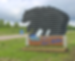
- Grizzly Bear Sighting...Up Close!
From Whitehorse, it's an easy two hour drive, about 96 miles along the historic Alaska Highway, to Haines Junction. The highway community of Haines Junction is nestled at the base of the St. Elias Mountains and the junction for the Haines Highway south. So the scenery changed dramatically as the 7,000 to 9,000-ft. summits of the Kluane Mountain Range parallel the highway; also the St. Elias Mountain Range just to the west contains many of Canada’s highest peaks, including Mt. Logan at 19,550 ft. We were fortunate to be coming down the highway and experience our first Grizzly Bear sighting! It appeared to be young and was next to the road eating yellow flowers. As we slowed to observe I got out my Nikon D700 with a 80-200mm telephoto lens. Stopping, I parked and turned on my hazard flashers about 15 to 20 yards from the animal really expecting it would run off. Instead it acted as if I wasn't even there and continued its meal. From my driver's seat I captured a few images just over the hood of the truck. At this point I thought, what the heck, toot the truck horn and see what it does, hoping it would at least look up at the sound. Much to my surprise It never looked up and frankly appeared to care less about our presence. I rolled slowly by so Sean and Kathy could get their photos and we continued on keeping a sharp lookout for other wildlife. We were driving towards Kluane Lake located in the southwest area of the Yukon; it is the largest lake contained entirely within Yukon at approximately 158 square miles and 50 miles long and home to the infamous community of Destruction Bay. Our destination was Congdon Creek Campground at Mile 1071 on the Alaska Hwy near Destruction Bay; a very pretty campground for dry camping with some sites close to the lake. It is first come, first serve and big rig friendly. The tent area is enclosed inside an electric fence because of bear activity. Really?! There are pit toilets as well as free fire wood. There are some pull thru sites but not all are big rig friendly since they have a very sharp turn to them or have trees close to the site. We were fortunate to get two pull thru sites near one another. The campground is outside Destruction Bay which is a small community on the Alaska Highway (historical mile 1083) in Canada's Yukon on Kluane Lake. It is populated mostly by non-aboriginal residents; community residents provide Yukon government services in the area (school, highway maintenance), including nearby Burwash Landing, and some tourism-related businesses along the Alaska Highway. The name is derived from the wind blowing down structures erected by the military during highway construction in 1942–43. We camped here for one night on Friday, June 28th but we sure could have stayed longer. The setting here was stunning and peaceful; I enjoyed the quiet interrupted only by the lapping sound of the lake nearby. But we are now so close to the goal and getting a bit anxious about the next leg of the trip. From Destruction Bay to Tok, Alaska we heard reports that this would be the worst part of the highway. With another day without cell coverage or internet, it adds to the uncertainty of our situation. Questions like; How fast can we safely drive? How long will it take? Is there road repair happening on Saturday? Ultimately, it doesn't matter because we didn't come this far to turn back around now. Our intended plan is to get to the US Border crossing and into Alaska on Saturday, June 30. This is a journey of 232 miles and over four plus hours of driving. Yeah, but tomorrow we will be sleeping in Alaska!
- More Than Halfway Now
Journeying to Whitehorse in the Yukon from Watson Lake would take us through known caribou country, over black spruce tree covered hills, valleys, lakes and sharp curves. Eventually we crossed the Continental Divide at 699.4 miles from the start of the Alaska Highway in Dawson Creek. We are now over halfway to the end of the Alcan in Delta Junction, Alaska with 687.6 miles still to go. As you are standing on the continental divide – the ridge line that separates two of the largest river drainages in North America-the Alaska Highway crosses the divide at one of the lowest points. Only humps of sand and gravel separate the west-flowing Swift River from the east-flowing Rancheria River. Drop a leaf into the Rancheria River to the east and it would float to the Liard River near Watson Lake, continue to the Mackenzie River in the Northwest Territories and eventually reach the Beaufort Sea (Arctic Ocean); a long journey of 2,650 miles for our waterlogged leaf. Drop a leaf into the Swift River to the west and the current would take it to Teslin Lake and the Teslin River. The Teslin flows northwest to the Yukon River which cuts across northern Alaska en-route to the Bering Sea (Pacific Ocean); a journey of 2,300 miles. We cross back over the border with British Columbia at Swift River then back into the Yukon near Lake Morley. The road conditions are favorable with some 6 to 7 percent grades to deal with while pulling a 13,000 pound fifth wheel. Again, thank goodness for the exhaust braking and the turbo charged features of the one ton RAM 3500 diesel truck. We have enough control to brake and accelerate whenever necessary to keep us safe. We drive over the Nisutlin Bay Bridge-the second longest water span on the Alaska Highway at 1,917 feet in length- before we pass through the town of Teslin at Historic Milepost 804, population 239. We are at 2,239 feet in elevation and only 111 miles from Whitehorse. We stop to fuel up in Johnson's Crossing, population 10, and continue by Marsh Lake, our original campsite location, until we considered Caribou RV Park instead which is 14 miles south of Whitehorse. Caribou RV Park was highly rated, but in truth it was over-rated in our opinion; tight sites, close together with water and electric at $64 Canadian ($46 US). I guess the advertising worked, but too late to change our minds at this point in the trip, so we paid for the one night only. We drove into Whitehorse to get some information and have dinner. I was shocked at the amount of graffiti on the buildings in town; just didn't expect to see that kind of urban blight in a region associated with all the natural beauty. The Visitor's Centre was a good first stop. We got plenty of good information and some local recommendations for places to eat. We left the truck in their parking lot and walked up the Yukon river to the SS Klondike. SS Klondike is the name of two stern-wheelers, the second now a National Historic Site located in Whitehorse, Yukon. They ran freight between Whitehorse and Dawson City, along the Yukon River, the first from 1929 to 1936 and the second, an almost exact replica of the first, from 1937 to 1950. Klondike I was built by the British Yukon Navigation Company (a subsidiary of the White Pass and Yukon Route railway company) in 1929 and had the distinction of having 50% more capacity than a regular stern-wheeler, while still having the shallow draft and meeting the size requirements in order to travel down the Yukon River. Klondike I had a cargo capacity of 270 metric tons without having to push a barge. In June 1936, Klondike I ran aground north of The Thirty Mile section of the Yukon River (at 61°40′17″N 134°52′22″W). The company salvaged the ship's boiler, engines, and many fittings to build Klondike II the following year. The remains of the hull of the Klondike I can still be seen at low water by canoeists on the Yukon River. Klondike II carried freight until the early 1950s. Due to the construction of a highway connecting Dawson City and Whitehorse, many Yukon River stern-wheelers were decommissioned. In an attempt to save Klondike II, she was converted into a cruise ship by White Pass and Yukon Route. The Duke of Edinburgh (consort of Elizabeth II, Queen of Canada) was invited to tour the ship in 1954, being taken on a short trip down the Yukon River and back to Whitehorse during his day-long visit to the city. The cruise venture shut down in 1955 due to lack of interest and Klondike II was left in the Whitehorse shipyards. The ship was donated to Parks Canada and was gradually restored until 1966, when city authorities agreed to move the ship to its present location, at that time part of a squatters' area. The task required three bulldozers, eight tons of Palmolive soap, a crew of twelve men, and three weeks to complete. Greased log rollers eased the process. On 24 June 1967, the SS Klondike was designated a National Historic Site of Canada and she is now open during the summer as a tourist attraction; except this summer, because S.S. Klondike is undergoing extensive restoration and lead removal work. This is a long-term project. During this time, the boat is not be accessible to visitors. We found our first totem while walking through the Friendship Peace Park along the river-walk in Whitehorse from the SS Klondike. This Friendship Totem Pole was created by Stan Peters in 1973. It is located in Rotary Peace Park near the Yukon River. This totem pole was made to encourage unity and friendship among all Yukoners. As in any art, there is symbolism in everything you see. Starting from the top of the pole: The Thunderbird with outstretched wings represents power and protection. He controls rain and ensures vegetation growth. Prominent in Indigenous legends, the thunderbird is depicted as strong enough to pull a killer whale out of the water with his talons. Only the most powerful and successful chiefs and families use the thunderbird in their crest. The Wolf holding “Skookum Jim” Mason, represents one of the major Indian clans. Mason is one of the men credited with finding the first gold nuggets in the Klondike Gold Rush of 1898. The Crow, represents the second major Indian clan. The Beaver symbolizes economy and trade, especially the fur trade. The Bear symbolizes motherhood and is the protector of the animal kingdom. With its great power and human-like qualities, the bear is known as the Elder Kinsman. The bear also symbolizes strength, by supporting everyone above him on the totem pole. The Colors are also symbolic: Black represents the charcoal of campfires. Red symbolizes mother earth and white represents the rapids that existed on the Yukon River. We finished our day trip to Whitehorse with dinner at the Cooper's/Dirty Northern, a cozy neighborhood pub serving creative comfort fare, craft beer & cocktails in laid-back surroundings. Between the 4 of us, we ordered some pizza creations, bison burger with salad and a chicken burger with fries to satisfy our appetites after a long travel day and self-guided tour of the town. Back to the Caribou RV Park to get some sleep and prepare for the next leg of the journey.
- Into the Yukon Territory
In preparation for leaving Liard Hot Springs Provincial Park heading to Watson Lake in the Yukon we filled our trucks with diesel fuel before the fueling station closed. At $2.20 Canadian per liter it feels like we are paying California fuel prices! That’s about $6.11 per gallon after the conversion, but fuel locations can be some distance apart so regardless of the price at the pump we fill up whenever possible. We make it a practice of looking for fuel as soon as we are at half a tank and it has worked out well. Wednesday, June 26, 2024, is the sixteenth day on our journey north from the lower forty-eight. We’re always on the lookout for any wildlife along our route and today we got some long expected satisfaction. Eighty miles into the trip on the ALCAN we spotted a black bear on the right side of the highway. Our excitement was tempered by the realization that he or she was ...pooping. Not a Kodak moment, exactly, but it was a bear sighting! Another black bear eating grass came later, but the real treat was near the Historic Mile 596 and the Hyland River when we observed in the distance a mama black bear with two cubs eating grass on the south side of the road. This time we slowed and pulled over hoping she wouldn't run off into the trees with the cubs, We rolled by, stopped up the road and got some photographs from a safe distance. We felt very fortunate to catch this amazing treat that many Alaska Highway travelers get to see along the route. This is beginning to feel like a window into a Jack London novel. Unique wildlife sightings and incredible scenic landscape vistas are becoming a daily occurence. What will we see around the next turn? Wednesday, June 26, 2024 we left British Columbia and crossed into the Yukon Territory at 60ºN Latitude making an important stop to get take this photo for the blog. This first sign, "Welcome to Yukon" is uniquely covered with stickers and autographs of many travelers to the territory. This would be the first of many dips in and out across the BC and Yukon border as we travel generally west. When we arrive at Historic Milepost 635, "Gateway to the Yukon" we are 330 miles northwest of Fort Nelson and 275 miles southeast of Whitehorse in Watson Lake, Yukon. Originally known as Fish Lake, Watson Lake was renamed for Frank Watson, who settled here in 1898 with his wife Adela Stone, of Kaska First Nation heritage. Watson, who was born in Tahoe City, California, had come north looking for gold. Watson Lake was an important point during the construction of the Alaska Highway in 1942. The airport, built in 1941, was one of the major refueling stops along the Northwest Staging Route, the system of airfields through Canada to ferry supplies to Alaska and later lend-lease aircraft to Russia. Today Watson Lake is best known for its "World Famous" Sign Post Forest started by Carl K. Lindley of Danville, Il., a U.S. Army soldier in Company D, 341st Engineers, working on the construction of the Alaska Highway in 1942. Travelers are encouraged to add a sign to the collection and they now number more than 100,000! Sean, Kathy, Karen and I added a contribution to the forest, hopefully a lasting memorial to this trip of a lifetime. All the spaces at eye level or below were taken years ago, so we needed a ladder to mount ours. It is secured with two wood screws to a 6x6 post near the southeast edge of the forest now totaling at least 100,002 signs. After our signs were mounted we visited the nearby Visitor's Center to get more brochures, maps and the local information. Later it was on to the Baby Nugget RV Park to stay the night in their "Dry Camping" lot. We fueled up once again the next morning and got back on the road with the expectation of reaching Caribou RV Park south of Whitehorse, Yukon. This leg of the journey would be a four plus hour drive and put us 246 miles closer to Alaska.
- Getting into Canadian Hot Water
Leaving Fort Nelson, British Columbia northbound we decided to drive all the way to Liard Hot Springs Provincial Campground. The highway veers to the west and winds through the Northern Canadian Rockies for the next 200 miles. It is a densely forested region and there are many scenic vistas where rivers meander through the wilderness only to disappear in the haze of the horizon hundreds of miles away. About 22 miles outside of Fort Nelson, near the Steamboat Creek bridge, we spotted our second Black Bear. Our last bear sighting was outside of Jasper. BC on the Icefields Parkway. We are on high alert for wildlife on this leg of the ALCAN. The Milepost book and highway signage has numerous warnings for moose, bear, caribou and Stone sheep. As we reach mile marker 357 we reach the Tetsa River Services and Campground. Advertised as a “must stop” on your Alaska Highway vacation and known for their world-famous cinnamon buns (said by thousands to be the best they ever had); well….they were closed! Bummer. We continued onward, disappointed after looking forward to “the best cinnamon rolls in the galaxy”, I’m now eating a granola bar as we drive. Crossing the Tetsa River bridge with a clearance of 17 feet over a metal grating roadbed, we near the Stone Mountain Provincial Park. Just past Muncho Lake Provincial Park we watch for caribou and Stone sheep. Stone sheep are frequently spotted in this area. They are indigenous to the mountains of northern British Columbia and southern Yukon. Darker and somewhat slighter than the bighorn sheep found in the Rocky Mountains, they are often mistaken for mountain goats, which are not found in this area. We spotted some on the cliff side as we drove by Muncho Lake; there were 5 sheep in a group walking on the rocks just to the right side of the road. Just prior to arriving at the Liard River Hot Springs Campground we observed a juvenile caribou. Not an attractive specimen and rather awkward looking. At historic milepost 496 we turned into the park and found it was full for the night. Our option was the overflow parking lot across the highway, which we gladly took for $26 dollars Canadian ($19 USD). After checking in we set up next to one another and decided to do a recon of the provincial park campground and hot springs facilities. Personally I was glad to be in the overflow parking area after looking at some of the campsites in the park because we had more room. The park is completely surrounded by an electrified fence to keep out the bears in the neighborhood and the main gate is locked from 10 PM until 6 AM. From the campground, we walked along the boardwalk out to the hot springs. Liard River Hot Springs has long been a favorite stop for travelers on the ALCAN. We got set up and took a walk to check out the facilities. From Aboriginal Peoples to fur traders to gold prospectors, people have been attracted to the hot springs for a long time. The American Army built the first boardwalk and pool facility in 1942 during the construction of the Alaska Highway. We walked back to our RV’s and decided to make an Earley dinner (Sean and Kathy’s last name, not a mis-spelling!) and come back later to soak in the hot springs after the afternoon crowd left. We built a campfire and the Earley’s prepared their classic camping culinary specialty of “Chili Mac” on the open fire in a dutch oven. It was worth the wait and I personally enjoyed two helpings. We even had enough to invite our RV neighbors Bob and Virginia from Oregon over for dinner. The smell must have attracted a neighboring black bear who wandered by across the creek just ten yards behind our camp. We all got a good look at it just walking by and never stopping…thankfully. After dinner it was off to the hot springs to enjoy the warm water of the this natural wonder. This hot spring is the second largest known thermal spring complex in Canada, with at least six springs feeding into different pools and streams that drain into the marsh. The resulting wetlands or swamps, instead of a creek or stream, doesn’t even freeze during the winter. Temperature of the water ranges between 36ºC (98ºF) at the Alpha Pool down to 12ºC (54ºF) along the boardwalk over the swamp. It felt quite warm when you first entered the main pool but cooled as you moved through the pool. There are concrete benches in the middle of the pool to sit on and benches along the pool by the stairs from the deck. It is a beautiful facility with washrooms and changing rooms available, benches around the deck area, storage bins for your dry clothing and towels. We soaked about an hour enjoying the quiet pool environment and taking in the total hot spring experience. What a wonderful place to stop and take in and rest to recharge before getting back on the road.
- Three Hundred Miles Up the ALCAN
We departed Dawson Creek at 8:30 AM on a sunny Sunday morning and began the first day of our trek up the ALCAN highway. The weather forecasted for this travel day was predicting rain, sometimes heavy at times, so we anticipated getting wet along the route. After stopping for fuel about two hours into this leg of the trip we thought it wise to continue on to Fort Nelson, British Columbia instead of staying at our original intended campsite at the Sikanni River Campground & RV Park at Mile 162 Alaska Hwy, Pink Mountain, BC. This campsite was located at the bottom of a steep highway grade and was just past a bridge re-construction site. Besides the pouring rain, I'm sure we would have had to endure the sound of truck exhaust brakes the entire time we stayed there. This would work out to be another long travel day of about five hours long. We had our eye out for wildlife along this route, but alas we only saw a dead female moose on the side of the road. It was the size of a dairy cow and would do some serious damage to our truck. Hense, we keep our heads on a swivel as we are traveling. We arrived in Fort Nelson at 2 PM and decided to stay two nights at the Triple “G” Hideaway RV Park & Campground at Mile 300 on the famous Alaska (Alcan) Highway, in Fort Nelson, British Columbia. Fort Nelson, named in honor of the British naval hero Horatio Nelson, 1st Viscount Nelson, was established by the North West Trading Company in 1805 as a fur-trading post and is the gateway to the Northern Rocky Mountains and the Muskwa-Kechika Management Area. Life in Fort Nelson began to change drastically in 1941 and 1942 mainly as a result of World War II. The Northwest Air Staging Route established an airport in 1941. The population of Fort Nelson increased substantially in 1942 with the arrival of US Army troops to begin construction of the Alcan Highway, now called the Alaska Highway. With so many people working on the highway, it only took 9 months to survey and build the 1500 mile stretch of road. During the construction of the Alaska Highway it became a larger settlement due to the influx of people. Today Fort Nelson's economy is diversified into oil and gas, forestry and tourism. Since 1942 Fort Nelson's history is a history of modern experiences. The economy has expanded to include more than just fur trapping. It now includes guide outfitting, the forest industry, oil and gas industry, farming, transportation and tourism. According to Wikipedia, contrary to popular belief that the construction of the Alaska Highway commenced in Dawson Creek, Fort Nelson was the original Mile 0 on the Alaska Highway because of the existence of a previously constructed road from Fort St. John to Fort Nelson. The United States Army built perhaps the most notable historical artifact in the area, the Alaska Highway. Construction began in 1942 out of a firm belief that Alaska faced a significant threat of Japanese invasion. Initial highway construction was performed by over 11,000 U.S. soldiers. After approximately nine months, the highway was finally completed, making Fort Nelson a bustling service-centre along the road. After the Japanese surrender in 1945, the U.S. Army ceded the Canadian portion of the highway to the Canadian government, which it made accessible to the public in 1948. A little competitive controversy between two Canadian cities, I suppose. After we got set up in the rain, we relaxed before an early dinner at the Triple "G" Saloon and restaurant. In addition to their normal dinner menu, tonight they were offering an extensive buffet. After looking at the selection of items offered we chose to go with the buffet. Joe and Debbie, a couple from Minnesota we met while in Dawson Creek, joined Sean, Kathy, Karen and I for dinner. We later all got together for a card game of 4up, 4down in our rig and had a great time of it. Lots of ribbing and laughter to close a great day of travel. Monday will be a day of rest. Many of the rigs we observed on the road yesterday are pulling out early. The exodus of RV's, all shapes and sizes, is almost continuous during the morning hours. Joe and Debbie are already on the road again but we will stay another day to relax. By the early afternoon I imagine the pattern will repeat again with another massive arrival of RV's, of all shapes and sizes. This must be the summer life rhythm of the RV campgrounds on the ALCAN. I got up early to enjoy a restaurant breakfast of 2 eggs, bacon, potatoes, rye toast and coffee while Karen is sleeping in. We need to get some more diesel fuel for the truck before tomorrow, so a trip into town is on the agenda. Sean and I might play disc golf later if the weather clears up. Other than these few chores, we chill until tomorrow. Tuesday, June 25 we plan on a drive and stay at Muncho Lake Provincial Park, Strawberry Flats campground at Mile 438 Alaska Hwy, Muncho Lake, BC. For the next few days our internet and cell coverage will be spotty at best, so it may be a while before you see any new postings on the blog. Stay tuned!